We left La Conner, Washington and drove north to Blaine, Washington which is right at the border with Canada. It was only about an hour drive to the Birch Bay Thousand Trails RV park. We picked a site in their Phase II section so Al backed us in and we have nice room between sites but we are right next to the Nature Trail so some foot traffic on the trail.


We went to Bellinham, WA the next day and got diesel for $4.75/gallon at a Native American Indian run 76 station in Salish Village! We're liking that price!
The next day we drove to the post office in Blaine to get our mail. Then walked around the downtown and ate a giant ice cream cone.


 |
| This is as far as we could walk towards Canada. We didn't see anyone around to stop us but didn't want to take our chances. |


 |
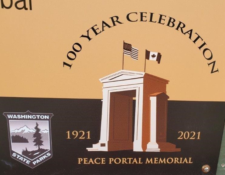
| This Unfortified Boundary Line Between the Dominion of Canada and the United States of America should quicken the remembrance of the more than a century old friendship between these countries. A lesson of peace to all nations. Erected April 25, 1936 |
 |
| In Commemoration of One hundred and fifty years of peace. 1814-1964 between Canada and the United States of America. The signing of the Columbia River Treaty on September 16th, 1964 at this International Peace Arch Park by the President of the United States, Lyndon B. Johnson and the Primer Minister of Canada, the Right Honorable Lester B. Pearson P.C. |
There were a lot of little monuments marking the line between the countries.


 |
| Shh...I stepped on the Canada side to capture this photo. |


 |
| All those guys were walking on the Canadian side but the Border Agent was keeping an eye on them! |


At the park there were information boards with border line information such as:
Negotiations of 1823-24
In 1824, the British proposed that a line should be drawn from the Rocky Mountains "due west along the 49th parallel of north latitude to the point where the parallel strikes the great north-eastermost branch of the Oregon or Columbia River, marked in the maps as McGillivray's river, thence down along the middle of Oregon or Columbia to its junction with the Pacific Ocean."
The American negotiator was instructed to first ask for the 51st parallel and if not agreed to by the British, then fall back to the 49th parallel.
 |
| If you can see on the map, the US wanted the line in purple and the British wanted the red line. |
Treaty of 1846
The negotiations for the settlement of the northwestern boundary were finally concluded in 1846. The first article of that treaty reads in part as follows:
"...the line of boundary between the territories of the United States and those of Her Britannic Majesty shall be continued westward along said 49th parallel of north latitude to the middle of the channel which separates the continent from Vancouver's Island, and thence southerly through the middle of that channel and of Fuca's Straits to the Pacific Ocean."
Unfortunately, this did not end the dispute. Both parties disagreed on where the "middle of the channel which separates the continent from Vancouver's Island" was actually located. Hostilities developed resulting in both American and British forces occupying San Juan Island in the disputed area. The line was finally arbitrated by the Emperor of Germany in 1872.
 |
| In 1857, the US Commissioner, Archibald Campbell, met with his counterparts for the water boundary, Captains James Charles Prevost and George Henry Richards, both of the Royal Navy. They soon disagreed on which channel was "the main channel separating Vancouver's Island from the Mainland." The "main channel" was supposed to the be boundary described in the Oregon Treaty of 1846. This disagreement soon escalated into the infamous "Pig War" in the San Juan Islands. US in Red Great Britain in Green Compromise is the dashed purple line |
We walked away from the border and out to the marina.


 |
| This isn't good! |
Our next day was a down day so I did an activity at the campground. I tie-dyed a t-shirt for $5.50 and it was fun. It came out pretty good I was surprised. Sorry, no photo of it but I did get a nice swirl like the photo.

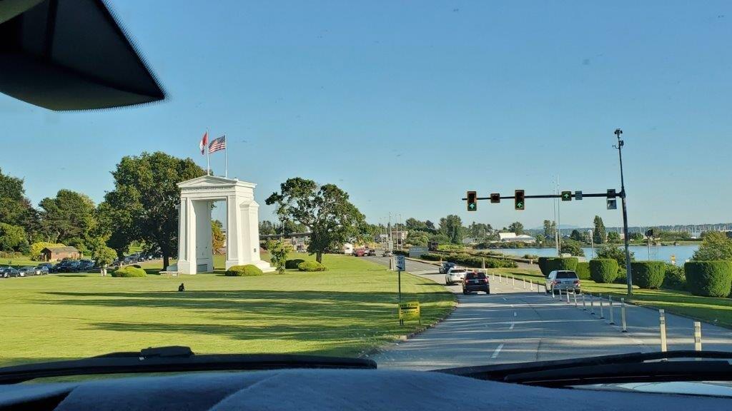
Another day we drove to Canada via the Peace Arch/Douglasville crossing.


Sign said no photos or video so I had to put the phone down.
When the Canadian Border Agent saw that we were from Texas he asked if we had any guns. Haha! Also, Al got selected randomly to do a Covid test. The Agent gave us an address for a lab to get a test which takes several days for the results. We were only in Canada for the day and the Agent knew that but said he was required to give Al the info anyway. We never went to the lab because what really was the point?


We went to Stanley Park in Vancouver where we walked
around and saw the Rose garden, Bridge, Totem Poles, Lumberman Arch, and
Seawall walkway. Then we walked all the way
over to the downtown and got Slurpee’s at 7/11.


 |
| Kiwanis Club Rose Plot First planted in 1920 to demonstrate the possibilities of rose culture in Vancouver "The City Beautiful" |


Stanley Park is huge at over 1,000 acres and there are so many things to see!


Back to the Peace Arch and to the border.


Check out this weird art sculpture just on the US side.

A U.S. art studio called Lead Pencil Studio has created a sculpture on the border between the United States and Canada that consists of a blank space in the shape of a billboard, surrounded by tangled metal. Titled Non-Sign II, the piece was commissioned by the U.S. government.
The artists behind it are Annie Han and Daniel Mihalyo, who've won numerous awards for their work over the last decade. The pair carefully twisted metal to give the appearance of a ghost of one of the billboards that populate the area.Han and Mihalyo noticed the way the area is packed with signs—advertising billboards, and then, closer to the border, a proliferation of government signs. Their hope is that their sign, flying by enigmatically ("What was that?"), will add a little bit of awareness to the whole signage landscape in the border zone. Just open up a free space, really. How very American. The empty rectangle frames only a view of sky as you drive by, nothing else.
Well, it got me to dig deeper.......

It was time to leave Blaine, Washington. On our route to the next destination we stopped off at the Snow Goose farmer's market recommended to us and ate giant ice cream cones! That should hold us over until dinner!


We made it to our northernmost point and now it is time to start heading south. Next we’re going to a county park north of Seattle and will catch the Angels play against Seattle at their stadium. Thanks for following along.
We appreciate all the comments so if you leave one, please include your name or initials so we know who left it. Mostly we see Anonymous as the author.


