After leaving the potato farm, we continued north to Chiloquin, Oregon. If this name sounds familiar, you would be right. We did this same route last year but a month earlier in the season. In Chiloquin we again stayed at the Ponderosa Pine Boondockers Welcome property and the same site. This property has several sites for RV's to park.
The next day we drove about an hour to Crater Lake National Park.

 |
| A park service boat on the lake |
We couldn't believe the difference a month makes in visiting the park. Last year we visited in mid-June and there was so much snow. Most of the roads were closed.
Here is a link to last year's blog entry: https://imagineourrvdreams.blogspot.com/2022/06/crater-lake-national-park-chiloquin-la.html
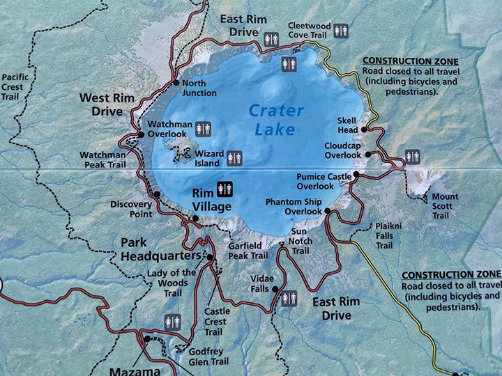
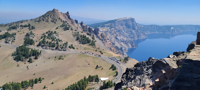
Most of the park was closed at that time and we were only able to visit the Rim Village area. This year there were only some small patches of snow remaining and so we drove along the West Rim Drive to do a 1.6 mile round-trip hike to Watchman Lookout.
 |
| Fire lookout tower |
What a view from the tower!
 |
| Wizard Island in Crater Lake |
 |
| A close up of Wizard Island |
 |
| Only a little bit of snow remains along the shoreline. |
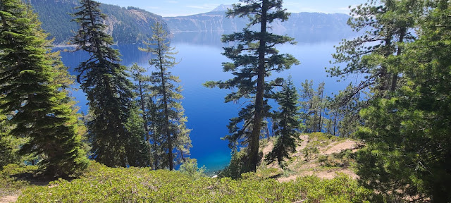
 |
| A portion of the shoreline |
How deep is Crater Lake?
Crater Lake is 1,943 feet deep. It's the deepest lake in the United States and the deepest volcanic lake in the world.
Where does the water come from?
Rain and snow. No rivers feed into the lake. Park Headquarters receives an average of 42 feet of snow per year.
Does the lake level change?
Not
much. The lake experiences twice as much precipitation as evaporation,
but the caldera doesn't fill up because water seeps out through a
porous rock layer along the north shore.
Are there fish in the lake?
Yes, rainbow trout and kokanee salmon. They were stocked from 1888 to 1941. Crater Lake contained no fish originally.
Does the lake freeze in the winter?
Very
rarely. Deep lakes freeze only in very cold weather. They contain a
tremendous volume of water but have relatively little surface area.
Crater Lake has not frozen over since 1949.
How did Crater Lake form?
Crater
Lake occupies the shell of Mount Mazama, a collapsed volcano. The
volcano once stood 12,000 feet tall but its summit imploded after a
major eruption 7,700 years ago.
 |
| Front side of Watchman Lookout |
 |
| Our truck is parked all the way over there. |
After we finished the Watchman Tower hike, we got back in the truck and continued north on West Rim Drive. We drove on West Rim Drive for as far as we could go before we had to stop due to construction. Unfortunately we were unable to drive around the whole lake.
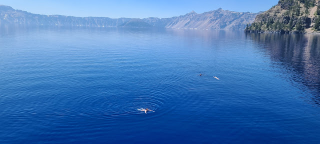
The road stopped at a parking lot for Cleetwood Cove which is about at the 1 o'clock point of the lake. Cleetwood Cove trail is the only legal access to the shore of Crater Lake. Depending on snow conditions, the trail is usually open from mid-June to late October. Swimming, wading and fishing are permitted in the lake.
What Not To Bring
To protect the clarity of the lake and decrease the possibility of introducing invasive species these items are not allowed in the lake:- scuba and snorkeling gear
- wet suits, masks, goggles, fins,
- inner tubes or any towable devices
- kayaks, canoes, and any motorized or non-motorized boats
- inflatable rafts, flotation devices
- personal life jackets or vests
- waders
 |
| A couple of people floating in the lake |
 |
| It was busy! |
There were many people jumping from some large boulders. It looked like fun but we didn't wear our swim suits.
During summer the average surface temperature of the lake is 57degrees (14 degrees Celsius).
We took off our socks and hiking boots and put our feet in the water.
After a while at the bottom, we slogged up the steep trail back to the top.
Walking back up was equivalent to climbing 65 fights of stairs!
There are boat tours on the lake but they were not in operation when we were there. Plus it is necessary to do the Cleetwood Cove hike to get to the boat launch area. I'm not sure when the boats will be back up and running.
When available, only interpretive boat tours and research vessels are permitted. Crater Lake is preserved as a scenic and scientific wonder, not as a recreational lake.
This was a completely different visit to Crater Lake than the previous year. I think it was more beautiful with the snow reflecting on the water but this time we got to do more hiking and get down to the shoreline. I'm glad we got to experience the lake both ways.
Next we're heading to Eugene and then over to the Oregon coast.
Thanks for following along......


.jpg)


We were amazed that the water temp was not as cold to get into for that time of the year. It was nice to see Crater Lake in a different atmosphere, I like all the snow since it makes it look so decadent.
ReplyDelete.