We left the Tillamook Elks RV Park before 11 and traveled north before arriving at Seaside Thousand Trails campground a little after noon.
We visited Seaside years ago with my Mom, stepfather, Tony, cousin, Sharon, and friend, Jackie. On that visit it was a day trip from Tigard, Oregon, near Portland. We were all in Tigard for my Uncle's wedding.
We got parked and set up in the North section of the campground.
The next day we walked over to the beach and watched the Seaside Volleyball Tournament.
At the end of Broadway Street there is a loop that overlooks the beach that contains a monument of Lewis & Clark.
 |
End of Lewis & Clark National Historical Trail |
While looking for things to see and do in the area we learned there was a beach volleyball tournament over the weekend.
Seaside Beach Volleyball is the LARGEST Beach Volleyball Tournament in North America.
Each year, over 40,000+ people from around the globe descend on Seaside for Four days of Volleyball on the incredible Oregon Coast.
From Amateur to Open Divisions and from junior to adults, we have divisions for each skill level. |
| Chairs placed to reserve spots to watch the big games. |
We enjoyed the 1.5 mile walk from the campground to the Lewis and Clark statues to watch some beach volleyball. There were SO many games going on for various divisions. On our walk back to the campground we picked more wild black berries from the bushes along the road.
We went to Costco in the evening and bought some more dungeness crabs. This time Al wanted to eat one too.
On Saturday we stayed at the campground and joined the swimming pool games and had a lot of fun and laughs.
On Sunday we walked back over to the beach and watched more of the Seaside Volleyball Tournament. This time we brought our chairs and the 1.5 mile walk over seemed a lot further! My chair got so heavy but it was more comfortable to watch the games!
During the week we went to do laundry, donate blood at a community center, and ate lunch at a yummy Japanese teriyaki place at the outlet center.
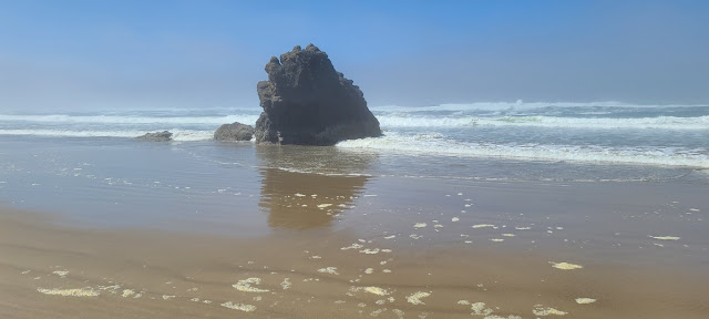
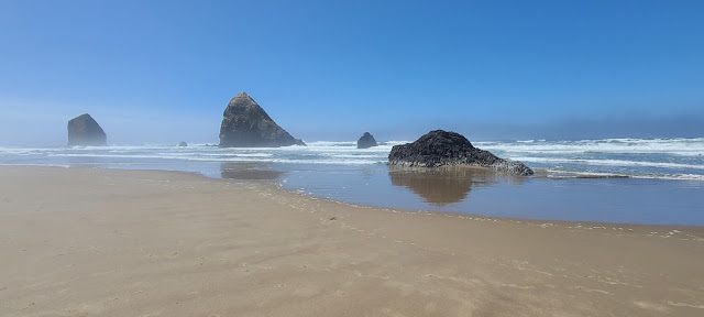
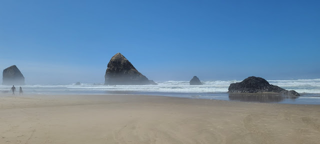
One day we drove south to Cannon Beach. We walked on the beach to see the famous Haystack Rock. It was so foggy on the beach we could barley make it out and it was right in front of us.
 |
| Our view of Haystack Rock |
 |
| The steep cliffs of the coastline |
 |
| Al spotted a Bald Eagle high up in a tree |
So glad the fog lifted and we were able to see the famous Haystack Rock at Cannon Beach.
The next day we hung out with our friends, Patty & Lenny, who were in the area for Lenny’s son’s wedding at the Haceta Lighthouse we visited recently. They came to pick us up at the campground and Patty brought us some tomatoes from her home garden near Bend, Oregon.
They took us to Lewis & Clark’s Fort Clatsop National Park. We watched a move, listened to a ranger talk, and I did another the Jr. Ranger badge.
Fort Clatsop was the encampment of the Lewis and Clark Expedition in the Oregon Country near the mouth of the Columbia River during the winter of 1805–1806
Here, at the end of their westward journey, the 33 members of The Corps of Discovery spent four rainy months preparing for their return to St Louis, Missouri. The men built huts to protect themselves and their supplies. They named it Fort Clatsop after the local Clatsop Indians.
Nothing remains of the original fort. This 2006 replica is based on William Clark's journal descriptions and floor plans.
Three sergeants and twenty-four men squeezed into three small enlisted men's quarters. Captains Lewis and Clark shared a room; as did interpreter Charbonneau, his Shoshone wife, Sacagawea, and their baby. Clark's slave, York, lived here too.
During the three months they spent at Fort Clatsop, Lewis and Clark reworked their journals and began preparing the scientific information they had gathered. Clark labored long hours drawing meticulous maps that proved to be among the most valuable fruits of the expedition.
The talk we listened to by a Ranger was this story:
Clatsop peoples’ homelands are south of the Columbia River, not far from the Pacific Ocean. They speak a Chinookan language and traded often with other people in villages up and down the river. Like other people living on the Lower Columbia River, they were expert canoe-makers and navigators.
Coboway was the leader of a Clatsop village located in what is now Fort Stevens State Park. In the winter of 1805, Coboway gave Meriwether Lewis and William Clark his blessing to build a house in the area.
Coboway and other Clatsop people visited and helped the expedition members many times during the winter of 1805–1806. They brought wapato (potato like tubular), berries, fish, whale blubber, dogs, otter skins, cedar bark hats, and canoes to trade with the visitors in exchange for manufactured goods such as glass beads, files, razors, other tools, and thread. Sometimes Coboway stayed overnight, and Lewis showed off the air gun to him. Coboway and his friends also helped two of the expedition members, George Drouillard and Jean-Baptiste Lepage, carry the animals they hunted back to Fort Clatsop.
Coboway was “the most friendly and decent” person in the area, wrote Lewis, after Coboway brought him a present of cured anchovies.
Lewis knew they needed a new canoe for the journey home, and he had tried to buy one from Clatsop people. However, the items Lewis offered—including his fancy dress uniform—were not a sufficient trade for the valuable canoe.
Rather than offer more, Lewis directed his men to steal a canoe: “we yet want another canoe, and as the Clatsops will not sell us one at a price which we can afford to give we will take one from them in lue of the six Elk which they stole from us in the winter.” But Coboway had already brought presents to make up for the stolen elk.
And so, after all Coboway’s kindness and hospitality, Lewis and Clark broke the trust established through months of friendship and trade with Clatsop people and stole a canoe.
We left Fort Clatsop and drove over to Fort Stevens where we saw the remains of the wreck of the Peter Iredale.
The Peter Iredale was a four-masted steel bark built in Maryport, England, in 1890 and owned by British shipping firm Iredale & Porter. On September 26, 1906, the Iredale left Salina Cruz, Mexico, bound for Portland, where it was to pick up a cargo of wheat for the United Kingdom. Despite encountering heavy fog, they managed to safely reach the mouth of the Columbia River early in the morning of October 25. The captain of the ship, H. Lawrence, later recalled that, as they waited for a pilot, “a heavy southeast wind blew and a strong current prevailed. Before the vessel could be veered around, she was in the breakers and all efforts to keep her off were unavailing.” The Iredale ran aground at Clatsop Beach, hitting so hard that three of her masts snapped from the impact. Fortunately, none of the crew were seriously injured. Captain Lawrence ordered that the ship be abandoned, and rockets were launched to signal for help.
The wrecked bark became an immediate tourist attraction. The day after the ship ran ashore the Oregon Journal reported that the wreck “proved a strong attraction…and in spite of the gale that was raging, scores flocked to the scene of the disaster.” They noted that the Astoria & Columbia River Railroad was already planning to run excursion trains to the site.
Although the ship has been broken up by wave, wind, and sand over the years, the wreck of the Peter Iredale continues to be a popular tourist attraction.
 |
| The wreck of the Peter Iredale is shown in this photograph, taken by Portland photographer Leo Simon on November 13, 1906, nineteen days after the ship ran aground near Ft. Stevens. |
 |
| Not much remains after 118 years of pounding surf and storms. |
Other days we did more activities at the campground like watch the Lego Movie and play candy bingo.
That was our visit to Seaside, Oregon. I learned a lot about Lewis and Clark that I ignored in history class in school, enjoyed watching some beach volleyball, and spending time with our friends, Patty & Lenny.
We're continuing north along the coast in to Washington state next.
Thanks for following along......


Loved the Bald Eagle pictures, I'm hoping we can spot one this summer when we are in that area. Thank you for another great post.
ReplyDeleteSo interesting!
ReplyDelete